


4.- Pinares del Neveral Path PR-A127
Jaén has grown and developed under the silhouette of Santa Catalina’s Castle, on the hill, protecting the city. At the foot of the southern slope, we can find the Almendral Quarter, whose higher part is limited by the ring road. From this point we can see a narrow path climbing diagonally through a field of abandoned almond trees, leading to a water tank which we will border. Then, our winding path enters into a pine grove, passing through two small houses and ascending until we reach the road, a few metres away from Caño Quebrado’s Fountain, where we find the roads that go the Castle and the National Parador.
In Caño Quebrado, our path joins to PR-A 126: the path of the Wall, until it reaches the recreational area of El Neveral, where they diverge.
We continue towards El Neveral Hospital, walking on the left side of the road for a short time. Then, passed the parking of the Forest house of Caño Quebrado, we continue on a path on the left, close to the road, in order to avoid walking on asphalt. Now, we cross a forest trail until we reach the recreational area of El Neveral, at this point our path diverges from PR-A the path of the Wall. We continue straight on, reaching a playground and a path with handrails that lead us to a border area between the olive and the pine groves. When the path with handrails split from the pine grove, we turn left taking a narrower path on one side of the pine grove. Then, we border the water tanks that supply water to the hospital. We continue ascending, looking right we find a picnic area and later a forest trail. At this point, the circular stretch of our path begins. This is the point where we will eventually return, on the right side of the path. Now, we cross the forest trail on the path that we can see in front of us; this path leads to another different forest trail. We turn right and continue ascending. We continue on the trail and we ascend again until we find a sharp turn belonging to a different trail. Right now we are at the highest point of our route. Now, we take the path on the right that descends rapidly. We return back to the place where the path cuts the forest trail (which is the end of the circular stretch). Now, we turn right and we cross a picnic area again, returning to the starting point of our route in Almendral Quarter.
INFOMATION ABOUT THE PATH:
Distance: 9.79 km
Expected time: 2 hours and 22 minutes
Maximum altitude: 1047 m
Minimum altitude: 616 m
Difference in altitude: 418 m
Paved stretch: 0.36 km
Vegetation type: Aleppo pine
Forest track or country road: 4.04 km
Path: 5.38 km
Signposting year: 2001
Conservation status: Good conditions and no difficulty, but most of the route signs have dissapeared, so it is important to be careful during the route.
Important aspects:
Attendance:
-Low, before the recreational area of El Neveral
-Medium, after crossing the recreational area.
Difficulty level: Average
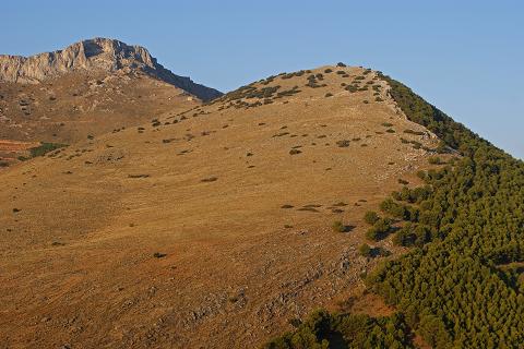
Environment: Forest, pine grove
Public infrastructure:
-The Neveral, Dr. Sagaz
-Neveral Reacreative Area
-Caño Quebrado Fountain (non- potable water)
Starting point access:
-Bus line 9
Stop at the Ring Road
Access to other parts of the trail:
-M12-5: Neveral Hospital (Dr. Sagaz):
Cartography: Map sheet 947-I E = 1: 25.000 National Topographic Map: National Geographic Information Centre


At the moment there are no defined events.
![]()