


5.- Path of Jabalcuz's Summit
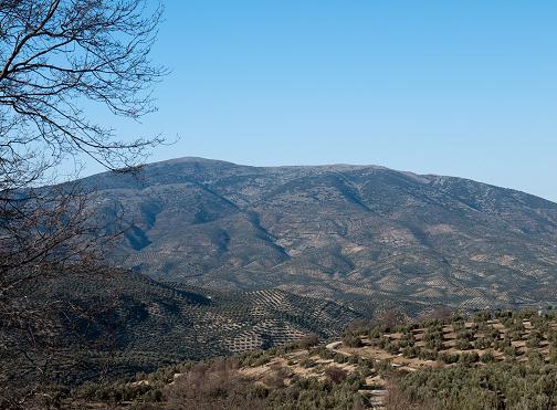
Jabalcuz is the higher and nearest mountain of the city of Jaén. It is a vantage point in front of the countryside where you can see most of the geography of the province due to its altitude, 1618 metres, and its isolated location. At its feet, there is a populated area also called Jabalcuz, four kilometres away from Jaén. In the past, there were big gardens and baths at this location; in the 20th century this place was very popular in Jaén. During the eighties, the hillsides were reforested with pine woods, creating a green wonderful landscape. It was necessary to excavate various mountain tracks in order to get from its base to a few metres from the mountain top, resolving a difference in level of 921.46 m over a distance of 10.3 km.
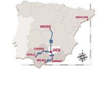
We arrive to the starting point of this route by Villares road, A-6050 taking the first access to Jabalcuz Residential Area, located 2.5 km from Jaén. When reaching a roundabout, take the first exit at the right that says Reguchillo (Jaén’s old road). 200 metres away from the roundabout, on our left, there is an asphalted track which is also the access to the Jabalcuz Residential Area. This first stretch does not have any vehicle restrictions. We can go by car until it is prohibited by the signs to go further, unless authorised by the AMA (Environmental Agency of the Regional Government of Andalusia). This first track is asphalted, it is one of the hardest because it has a steeper slope. We continue on the left on a steep cement lane parallel to the mountain top. This steeper cement lane ends in a curve on the right, where two livestock trails (Trompero and Cordel de Jabalcuz) meet. One can come by car and later, park it without difficulty, continuing on the path by foot. From that point, we begin to ascend on a gentle slope until we reach the first new plantation pines. As we go on our way we will find a barrier that prohibits the entry of unauthorised vehicles. The route continues along the main marked track, it is clearly recognizable to avoid confusions with other paths of the area. The route goes into a closed valley reforested with pines, that ends in Puerto del Aire 1331 m, an ideal place to relax for a while. We continue to the point where the trail splits. We continue on the left and it splits again into two trails, but now we turn to the right. From that point we will not have any problem to arrive to the top of the mountain, because we will continue on a single path.We continue until we reach an open area at the end of the path. From that area we can see a narrow path that leads to the forest house.
We return following the same route
Jabalcuz is the highest peak of a mountain, so the weather conditions are more extreme, even the hot weather. It is advisable to take the proper mountain equipment. It is important to keep in mind that there are no drinking-water facilities on this path. It is better to walk during the daylight hours, try to avoid the fog, rain and snow if we are not well-equipped. Avoid the trail during high risk of storms.
INFORMATION ABOUT THE PATH:
Type of path: Linear
Distance: 10.2 km to go
Expected time: 4 hours 50 min
Maximum altitude: 1618.46 m
Minimum altitude: 697 m
Difference in altitude: 921.46 m
Paved stretch: 0.7 km
Forest track or country road: 9.3 km
Path: 0.2 km
Vegetation type: Aleppo Pine, olive grove, almond tree, low-mountain area
Conservation status: Good conditions
Attendance: Low (weekends)
Difficulty level: High
Environment: Forest, middle mountain area
Usage: Hiking, cycling 98%(very difficult)
Public infrastructure: No
Starting point access: From Jaén through Los Villares road, A-6050, take the first access to Jabalcuz Residential Area (2.5 km from Jaén). When arriving to the roundabout, take the first exit to the right that says Reguchillo (Jaén's old road). 200 km fromt he roundabout, on our left we find an asphalt track that is the access to the residential area Bellavista. Jabalcuz. This is the starting point.
Buses
Access to other parts of the trail: Ascending Puerto del Aire, it connects with a forest track that descends and leads to rural paths (not signposted) that go to Torredelcampo
Cartography: Map Sheet 947-III E = 1: 25.000 National Topographic Map: National Geographic Information Centre


At the moment there are no defined events.
![]()